![]()
Call us at 1-800-463-3063
GPS for Surveying & Mapping
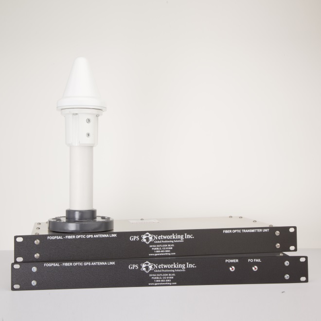
Surveying & Mapping is used in a wide variety of industries across the world. Civil engineers building roads, bridges, pipelines, train lines, etc. will survey before the first blueprint is drawn. Even farmers use surveying to map and plot their crops each planting season. To do this, a number of tools are used to precisely measure depth, distance, angle, elevation, including that of survey GPS equipment to triangulate an exact location. The demand to achieve prompt accuracy and precision is rapidly expanding into new markets and new industries worldwide. The requirement to have this information widely distributed with minimal degradation of the originating signal is also increasing. GPS Networking's signal distribution products are designed specifically to minimize system noise figure and timing delays for any application of GPS or GNSS system for surveying.
We have all the Surveying GNSS/GPS Equipment You Need
![]()
Our team of expert advisors will make sure your company has the best GPS signal distribution products to support your Survey/GPS applications. From civil engineering projects to lining out crops, we will be your GPS source for signal distribution products specifically designed to boost signal acquisition, eliminate timing delays, increase productivity and deliver accurate information for any GPS application. With your existing GPS signal, our products will provide the most accurate measurements possible by also cutting out system noise and timing delays.

Our experienced staff will ensure that you have the proper tools to exceed your project's objectives. Contact us today at 1 (800) 463-3063 and speak with an expert in the area.
Business Hours: 9:00 AM - 5:00PM MST

Click to view our AS9100D Certificate
The information contained on this website is subject to change without notice.
Click to view our AS9100D Certificate
The information contained on this website is subject to change without notice.
Business Hours: 9:00 AM - 5:00PM MST